


Khanh Hoa is the land of agarwood
Where high mountains and vast seas welcome those who come and go
Khanh Hoa - The land of agarwood and swallows' nests, has an eastern coastline stretching approximately 160km in a straight line, creating a coastal zone of 385km (measured along the waterline) and about 200 large and small coastal islands, as well as the coral islands of the Truong Sa Archipelago. Therefore, the geographical location of Khanh Hoa holds significant meaning and influence over factors such as the culture, society, economy, and national defense and security of Khanh Hoa province in particular, and the entire country in general.
Among these issues, one must mention Truong Sa district, a promising island district of Khanh Hoa province. Truong Sa district was established in 1982, including the entire area of the Truong Sa Archipelago, belonging to Dong Nai province. On December 28, 1982, Truong Sa district was transferred to Phu Khanh province, later known as Khanh Hoa province. In 2007, the Government established 3 administrative units under Truong Sa district, including: Truong Sa town and the communes of Song Tu Tay and Sinh Ton.
Truong Sa is located to the southeast of the Hoang Sa (Paracel) Archipelago, at coordinates 8° 38’ North, 111° 55’ East, ranging from latitude 6° 50’ to 12° 00’ North and longitude 111° 30’ to 117° 20’ East, with over 100 emergent and submerged islands, rocks, sandbanks, coral reefs, and atolls spanning an area of the sea from east to west of about 800km. The archipelago covers a sea area of approximately 160,000km2 to 180,000km2. The nearest island is Da Lat, located to the west of Truong Sa island, nearly 250 nautical miles (450km to the east) from Cam Ranh Bay, and over 600 nautical miles from Hainan Island (China). The islands have an average elevation of 3m - 5m above sea level. The largest island is Ba Binh island, measuring approximately 0.6km, followed by Song Tu Tay, Truong Sa, Nam Yet, Sinh Ton islands, etc.[1]
Previously, Truong Sa was named Dai Truong Sa or Van Ly Truong Sa, as recorded in the book 'Phu bien tap luc' (Miscellaneous Records of Pacification of the Frontiers) - a famous book by the scholar Le Quy Don written in 1776[2].
Located in the East Sea (South China Sea), the Truong Sa Archipelago is surrounded by fishing grounds with high yields and abundant oil and gas reserves. Natural resources include fish, bird guano, coral reefs, and potential oil and gas. Due to its proximity to sedimentary basins containing oil and gas, the Truong Sa Archipelago has great potential for hydrocarbons. However, the East Sea region has not been extensively surveyed, and there is no reliable data on the potential for oil, gas, and other minerals. This is also one of the regions with the highest maritime density in the world. As a result, Truong Sa has become one of the 'East Sea Issues', turning into a topical international matter.
Since ancient times, our ancestors have affirmed sovereignty not only on land but also over the East Sea, including the two archipelagos of Hoang Sa and Truong Sa, collectively known as Bai Cat Vang (Yellow Sandbank), Con Vang, Hoang Sa, Dai Truong Sa (Long Sandbank), or Van Ly Truong Sa (Ten Thousand Mile Long Sandbank). Despite having many names, the locations of the Hoang Sa and Truong Sa archipelagos have always been depicted on maps of our country throughout historical periods, such as: 'Toan tap Thien Nam tu chi lo do thu' (The Complete Map of the Four Directions of the Southern Sky) (17th century), 'Toan tap An Nam lo' (The Complete Route Map of Annam) in the book 'Thien ha ban do' (Map of the World) by Do Ba Cong Hao (7th year of Chính Hòa – 1686), 'Dai Nam nhat thong toan do' (Comprehensive Map of the Unified Great Nam) (18th century)[1], or the 'An Nam dai quoc hoa do' (Map of the Great Empire of Annam) by Bishop Taberd, published in 1838, which affirmed that Bai Cat Vang (Hoang Sa) is Paracel and lies within Vietnam's territorial waters.
The book 'Dai Nam nhat thong chi' (Comprehensive Geography of the Unified Great Nam) records the activities of the Hoang Sa and Bac Hai fleets, with the latter being supervised by the former. The Hoang Sa and Truong Sa archipelagos belonged to Quang Ngai province. The laborers and soldiers sent to the islands were provided with sufficient food and supplies for their maritime voyages. In addition to the tasks of patrolling, measuring nautical routes, and exploiting resources, the maritime fleets also built shrines and planted trees to assert sovereignty in the Hoang Sa and Truong Sa archipelagos.
Hoang Sa island: located to the east of Cu Lao Re, Binh Son district. From the coast of Sa Ky, it takes about three or four days and nights of sailing with favorable winds to arrive. There are over 130 small islands separated by either a day's journey or a few 'trong canh' (watches). On the island, there are yellow sandbanks that stretch continuously for thousands of miles, flat and wide, commonly called 'Van ly truong sa', with very clear water; on the beach, there are freshwater wells and countless seabirds gathered. The products are abundant in conch shells, sea cucumbers, hawksbill turtles, green sea turtles, and goods from Chinese merchant ships that were blown off course and drifted there.
Early in the present dynasty, the Hoang Sa fleet was established with 70 men recruited from An Vinh village. Every year, in March, they would set sail to search for marine products, and in August, they would return through Tu Hien seaport to submit them. The Bac Hai fleet was also established and supervised by the Hoang Sa fleet to collect marine products from the islands. To the east of Hoang Sa island, it is near Qiongzhou prefecture of Hainan island of the Qing dynasty. At the beginning of the Gia Long reign, the old custom of maintaining the Hoang Sa fleet was followed, but later it was abandoned. At the beginning of the Minh Mang reign, officials were often sent on government ships to survey the sea routes. They discovered a place with a white sandbank 1,070 'truong' in circumference, with lush green trees; in the middle of the sandbank, there was a well. To the southwest of the sandbank, there was an ancient temple, the construction time of which is unknown, with a stele engraved with four characters 'Van ly ba binh' (Ten Thousand Miles of Peaceful Waves). This island was formerly called Phat Tu mountain; the east and west sides of the island are surrounded by coral reefs submerged in the water. To the northwest, adjacent to the coral reef, there is a sandbank 340 'truong' in circumference, 1 'truong' and 2 'thuoc' high, level with the sandbank, called Ban Than rock. In the 16th year of Minh Mang, government ships were ordered to transport bricks and stones there to build a temple, erect a stone stele on the left side of the temple to mark the event, and plant various types of trees on the left, right, and rear sides. Soldiers building the foundation of the temple dug up more than 2,000 'can' of copper plates and cast iron[2].
During the French colonial period, the French divided our country into three regions: Tonkin, Annam, and Cochinchina. In which, the Hoang Sa Archipelago belonged to Annam (under the Nguyen dynasty
feudal court) and the Truong Sa Archipelago belonged to Cochinchina (under French administration). In reality, the French colonialists, in the name of Vietnam, carried out specific actions to exercise sovereignty over the Paracel archipelago (i.e., Hoang Sa and Truong Sa). The French placed sovereignty stelae and a meteorological station on the archipelago, but today no traces remain, only archival photographs.
In 1954, the Geneva Accords were signed, ending the war in Indochina and recognizing the independence, sovereignty, and territorial integrity of Vietnam. However, Article 1 stipulated that a temporary military demarcation line was set at the Ben Hai river (17th parallel), and Article 4 proposed that the temporary demarcation line also be extended in both parts by a straight line from the coast out to the sea. While awaiting the general election throughout the country, each side was responsible for administrative affairs in its respective regrouping zone. Therefore, at that time, the Hoang Sa and Truong Sa archipelagos in the East Sea temporarily came under the administrative management of the government in the South, i.e., the Republic of Vietnam government.
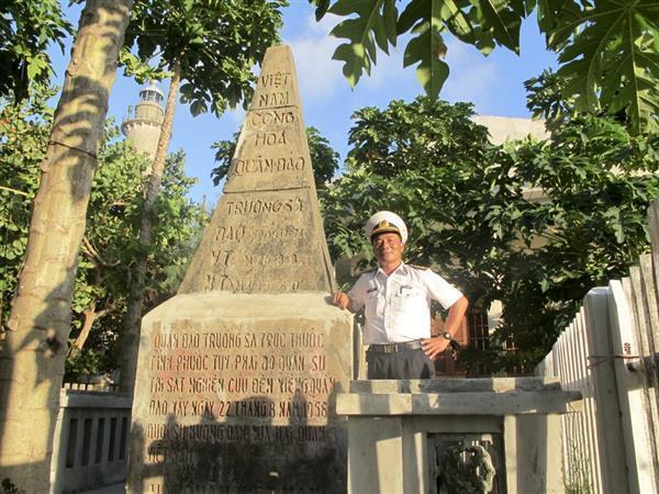
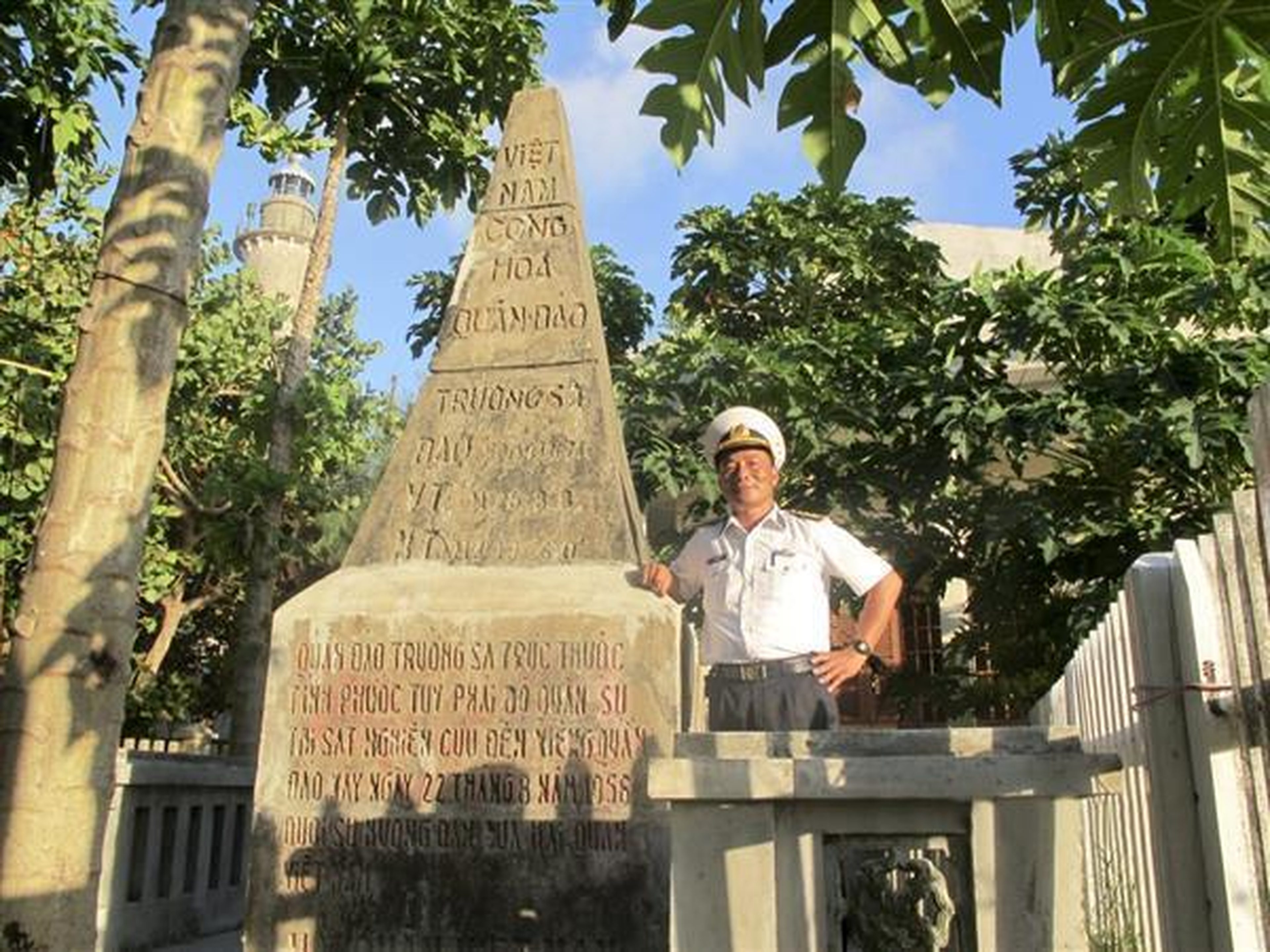
On August 22, 1956, the Military Mission of the Republic of Vietnam government conducted an inspection, and along with raising the flag, they placed sovereignty stelae on the main islands of the Truong Sa Archipelago. Over time and through historical upheavals, today only the stelae on Song Tu Tay island and Nam Yet island remain, having been constructed in 1956, and these are the two oldest stelae currently preserved in the Truong Sa Archipelago.
The sovereignty stele on Song Tu Tay island belongs to Song Tu Tay commune, Truong Sa district, Khanh Hoa province, at latitude 11° 25’ 55’’ North and longitude 114° 18’ 00’’ East. The sovereignty stele on Nam Yet island belongs to Sinh Ton commune, Truong Sa district, Khanh Hoa province, at latitude 10° 10’ 45’’ North and longitude 114° 22’ 00’’ East. The text on the stelae is carved into the stone, reading: 'Truong Sa Archipelago belongs to Phuoc Tuy province. The military mission surveyed, studied, and visited this archipelago on August 22, 1956, under the guidance of the Vietnam Navy'.
To protect the integrity of sovereignty and national unity, after the victory at Buon Ma Thuot, our Party and State urgently implemented strategies to liberate the South and unify the country in the dry season of 1975, including both the mainland and the islands of Con Lon, Phu Quoc, and the Truong Sa Archipelago...
Recognizing the typical historical values of the monuments and contributing to asserting sovereignty in the Truong Sa Archipelago, on June 13, 2014, the Ministry of Culture, Sports and Tourism issued Decision No. 1825/QD-BVHTTDL, ranking the Sovereignty Stelae of the Truong Sa Archipelago on Song Tu Tay island and Nam Yet island as National Historical Sites.
Along with the Hoang Sa Archipelago, the Truong Sa Archipelago serves as the nation's outpost in the East Sea. Today, Truong Sa has become a sentiment in the heart of every Vietnamese, becoming the slogan: 'The whole country for Truong Sa, Truong Sa for the whole country'. The two words 'Truong Sa' always evoke deep emotions, memories, love, trust, and admiration. Surely, everyone wishes to visit the islands, to visit Truong Sa to see the soldiers guarding the sea and sky of the Fatherland, and to set foot on the furthest island district of the nation.
Protecting sovereignty in the East Sea is a necessary task with long-term strategic significance, as Uncle Ho taught the Vietnam People's Navy: 'In the past, we only had the night and the forest. Today, we have the day, the sky, and the sea. Our coastline is long and beautiful; we must know how to protect it.' Every Vietnamese citizen needs to understand and be conscious of protecting the sovereignty of the country's territory and territorial waters. Each person is a message sent to friends around the world to affirm Vietnam's sovereignty over the two archipelagos of Hoang Sa and Truong Sa, and that is also an effective way to contribute to preserving and promoting the value of the historical sites.
Source: https://disanvanhoa.khanhhoa.vn